|
Geocoding Images
|
|
|
|
|
|
|
|
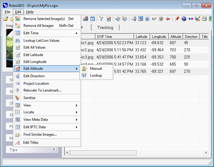
Edit Image Altitude
click on 'File', 'Edit' or 'Help' to navigate the documentation
|
|
|
|
Manually Enter the Altitude
Manually enter the altitude of the selected image.
Lookup the Altitude
If your photos contain latitude and longtiude information, you can lookup the altitudes using NASA's SRTM data. Note that this data only exists for most land areas between the latitudes of 60 degrees north and 56 degrees south and that it was recorded at 3 arc-second intervals (about 90 meters). Because of the recording interval, the data for areas with steep elevation changes may not be accurate enough for your needs.
|
|
|
|
|
|
|
|
|
|
|
© 2003-2025 Pretek, Inc.
|